


Description
by David Edwards-May, published Imray, 2021. This is the 6th edition of the valuable overall planning map of Europe’s waterways, covering the continent from Ireland to the Ural Mountains in Russia, from the White Sea and the northernmost lake systems of Finland to the Corinth Canal and the Guadalquivir River. Those planning to cruise through Europe need an overview of the routes available to reach their destination. This map shows all the waterways at a glance, making it the ideal planning tool for recreational boaters and other users of Europe’s extensive waterway network.
The map and detailed booklet give information on characteristics of the waterways, locks and local restrictions on draught and air draught, plus the contact details of waterway authorities and associations.
Overview on the front at scale 1:3 800 000. On the back, at 1:1 500 000 is a detailed view of the main system from England and Wales through to the Czech Republic and Bratislava on the Danube.
– Pull-out folding map, 1210 by 870 mm
– Complete overview of Europe’s waterways at a scale of 1:3 800 000
– Larger-scale detail of the central European network 1: 1 500 000
– 64-page directory of essential information for boaters, country by country
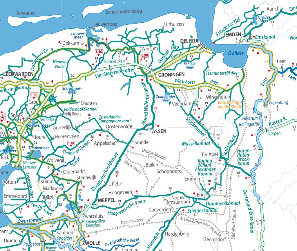
Extract from the enlargement for the Netherlands, Belgium and Northern France