
Description
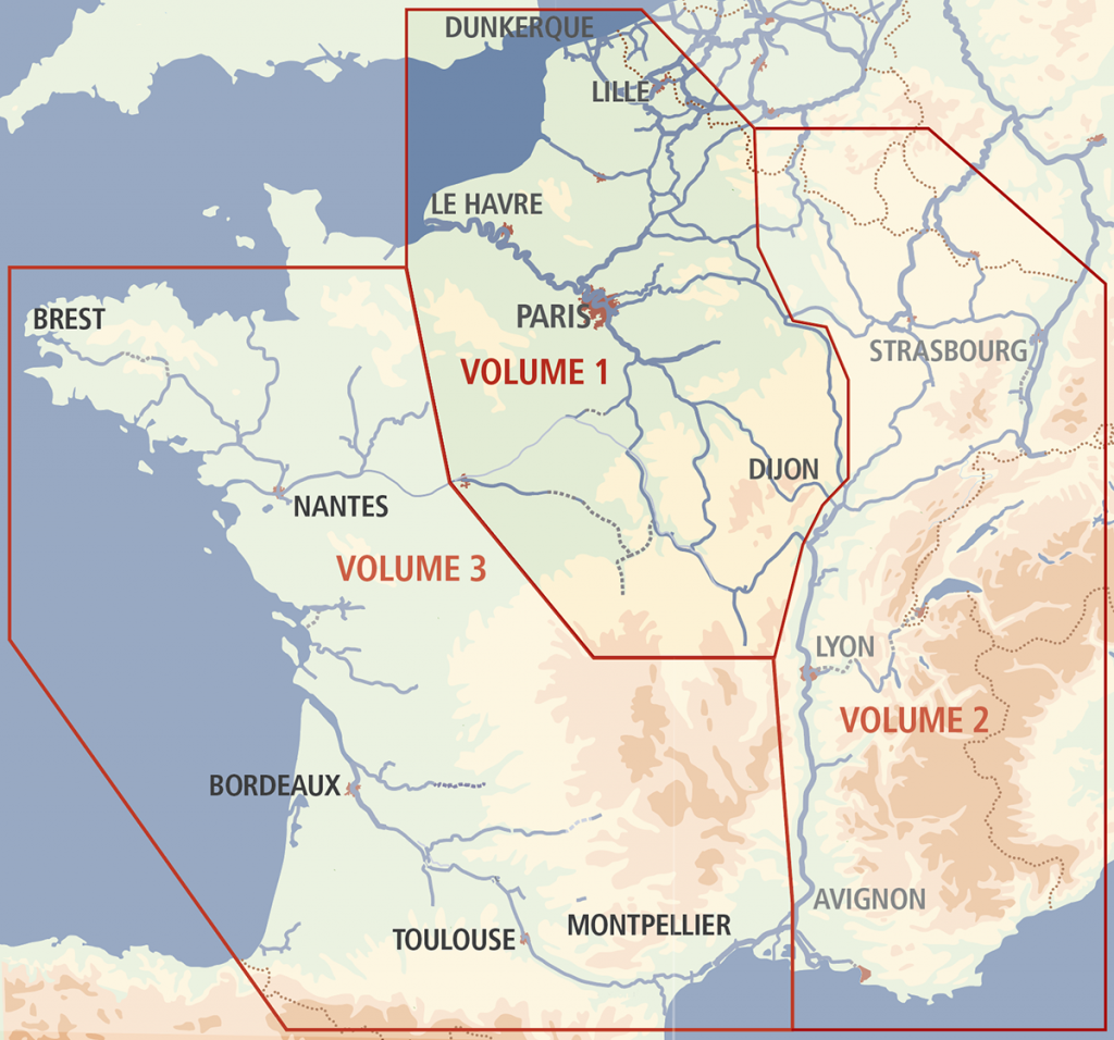
This has been the standard reference work on the French waterways for nearly 70 years. Since the 5th edition in 1983, David Edwards-May has continuously improved the work in presentation and detail. For the 9th edition the text has been completed with practical and tourist information on key locations, inserted into the route descriptions, kilometre by kilometre. Volume 1 covers the waterways from the north (the entry ports of Dunkerque, Calais, Saint-Valery and Le Havre) down to the Centre and Bourgogne regions.
The author has made many updates to the maps since the 2010 edition. Waterway junctions and main towns are shown with lots of valuable detail, without being cluttered. 200 colour photographs. This ninth edition is the most up-to-date source of information on the subject. The map shows the area covered by this volume, in relation to volumes 2 and 3.